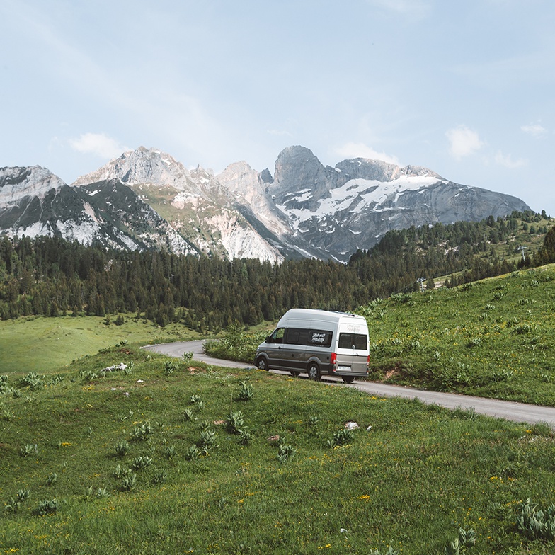
Travelling in a camper has a specific logistics that generic everyday apps do not resolve. You need to know where you can sleep tonight, whether the wind will change tomorrow, where the next LPG station is and whether the service area you have in mind has grey water disposal. All of that requires different apps depending on the moment of the trip.
You do not need to fill your phone with apps. With four or five well-chosen ones you have all the usual scenarios covered. This guide is about exactly that: what to download, what each one is for and how to combine them without overcomplicating things.
Navigation: Google Maps and Waze, each for a different purpose
- Google Maps is the general reference. Great for planning long legs, finding towns, campsites or points of interest and saving lists of places.
- Waze complements it well in heavy traffic or routes with a lot of changing conditions: it alerts you to speed cameras, roadworks and closures in real time.
- For campers, neither Google Maps nor Waze filters by vehicle height or weight. On mountain routes or narrow access roads, always cross-check with a physical map or fellow traveller references.
- Practical tip: use Google Maps to plan the day and Waze for the legs with more traffic or in urban environments.
Overnight areas: Park4Night and Campercontact
- Park4Night is the most widely used app for finding where to sleep: official areas, free overnight spots, campsites and service points. The best feature is recent comments with real photos.
- Campercontact is a good alternative, especially useful for service areas and grey water disposal points. It has a solid database for northern Spain and Europe.
- Always cross-check at least two sources before deciding on an overnight stop: conditions change and a comment from two years ago may not reflect the current situation.
- When you arrive in a new area, first look for options within 30 minutes as a plan B. Arriving late without a backup is the most common mistake.
Golden rule for overnight stops
Before closing the day, always have a plan B within 30 minutes. Park4Night with the map filter open and the nearby points option solves this in two minutes. Do not wait until you are parked with the engine off to start looking for an alternative.
Weather: AEMET and Windy for route decisions
- AEMET is the official Spanish source. Reliable for rain and temperatures, with hourly forecasts and adverse weather alerts.
- Windy is particularly useful for coastal areas, mountains or if you are planning outdoor activities: it shows wind, waves and clouds in layers with great visual precision.
- For campers, wind matters more than it might seem. A windstorm can make the night very uncomfortable or even dangerous in exposed spots.
- Combine AEMET for rain forecasts and Windy for wind. With both you get a much better picture of what to expect tomorrow.
Fuel: Gasolineras.es for LPG and diesel
- If your camper runs on LPG or autogas, Gasolineras.es (the CNMC app) lets you filter specifically for that fuel type.
- It shows live prices and distance, which is very useful for deciding whether to refuel now or carry on.
- For standard diesel, the same app works to compare prices between nearby stations on any stretch.
- Also available as a website if you prefer to check on the car's navigator.
Route planning: how to organise everything before leaving
- Google Maps lets you create saved lists by trip. It is the simplest way to keep all your route points organised without needing another app.
- For long trips with several legs, note key references in your phone's notes or a shared document: areas, towns with supermarkets, water and disposal points.
- Park4Night lets you save favourites and export lists for offline use, useful in areas with limited signal.
- Do not over-plan: block the nights and leave the days more open. That is the advantage of travelling by camper.
The difference between a smooth trip and one full of friction is rarely the vehicle. It is usually whether you know where you are sleeping tonight and what the weather is doing tomorrow.
The minimum setup that actually works
- Google Maps: daily navigation and general service search.
- Park4Night: where to sleep, service areas and real user reviews.
- AEMET or Windy: weather adapted to the route and terrain type.
- Gasolineras.es: fuel, especially if you use LPG.
- With these four you cover 90% of the usual situations on any camper trip.
Download maps for offline use
Both Google Maps and Park4Night allow you to download areas for offline use. Do this before leaving for any area with potentially limited signal: mountain zones, quiet stretches of coast or long rural roads. Two minutes of downloading can save a lot of time on the road.
Useful resources
Frequently asked questions
Do I need all these apps or will two or three do?
For most trips, Google Maps, Park4Night and AEMET cover the essentials. Waze and Gasolineras.es are very useful in specific situations but are not essential for every trip.
Is Park4Night free?
It has a free version with access to most features. The premium version unlocks more detailed filters and full offline use, but for basic use the free version works well.
What do I do if I have no signal on the road?
Download the Google Maps areas and Park4Night zones before leaving. That way you can navigate and search for areas without a connection. For weather, check the forecast each morning when you have signal and note the key data for the day.
Do these apps work outside Spain?
Yes. Google Maps, Waze, Park4Night and Campercontact work across Europe. Windy and AEMET have different coverage: Windy works globally, AEMET only covers Spain, but other countries have their own equivalent weather agencies.
With your phone well set up, half the planning work is already done. If you know where you are sleeping, what the weather is doing and where to refuel, the rest of the trip sorts itself out on the road. Browse the available routes to plan your next leg and book ahead to get the camper that best fits your plan.